
Sarawak Drone Aerial Photography and GIS Company
Regular updates at: facebook.com/tekgra and facebook/Sarawak drone aerial photography
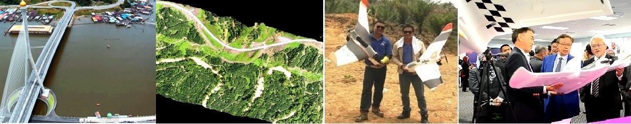
Tekgra is a Miri-based Sarawak drone aerial photography, inspection and geospatial mapping company with over 25 years of GIS mapping experience.
We are one of the most experienced drone mapping companies and pioneered the use of fixed wing drones (UAVs) in aerial photography and mapping in Sarawak in 2012. Our mapping services include roads, infrastructure and construction inspection, oil plantation mapping and censes. Geospatial services include earthwork/quarry volumetric calculation, contour lines, 3D DEM, gradient analysis, buffer zones, and change detection.
Tekgra has a range of VTOL fixed wing UAV drones especially suitable for large area mapping. We also carry traditional large fixed wing UAVs and multi-rotor drones.
WhatsApp us for a competitive quote with professional, high-quality services.